Tuesday, February 27, 2007

Maps and the Media


With daily news growing more important to people everyday, the importance of using maps to help illustrate this news grows as well. Using maps gives the media power to help disseminate information to the general public. Maps started appearing in the media with the development of newspapers. In many countries during the 1800’s, maps were included in the newspaper to show plans for new buildings and city areas. At the time, schematic maps in newspapers could detail natural disasters etc. that would help illustrate such events. With the beginning of the First World War, the use of maps jumped greatly in newspapers. These maps helped present information about what was happening on the war’s front. Some of the newspapers published full page maps of war theatres encouraging people to cut these maps out to help them keep track of the war. These maps would also help to educate people who could not afford to purchase maps or atlases. After world war one the use of maps jumped greatly in newspapers until the arrival of television in the second half of the century. With the development of television in the middle of the 20th century, the power of maps greatly expanded. Allowing people to get the news much faster, television has also helped increase the use of maps. Maps are used in a wide variety of ways on television. In their simplest form, a map is usually used during the traffic segment of a local newscast. Using a reference map of a specific area, the news station can not only tell you, but also show you exactly where there is an accident or a slow down on a road or highway. For some people who can’t understand by listening, looking at a map is an easy way to visualize where the events are taking place. Another good example of news stations on television using maps is during the weather segment. During the weather report, many maps are used to show the viewer exactly what is going on with the weather at a given time. Some of these maps may be aerial photos from space showing cloud cover or they might just be radar maps showing precipitation in the area. Maps of an area showing the temperature of each city is also map that news stations like to show during the weather segment. Lets face it, maps are an essential part of helping viewers understand the news. Without maps, most people would be lost.
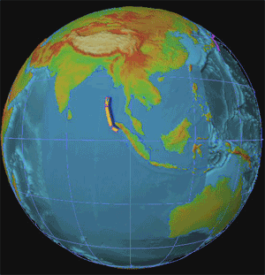
Maps are very important in the news today. With newspapers and news stations disseminating news 24/7, the power and importance of maps continues to grow and will continue to grow. The map in the top left corner shows what a typical weather map might look like during a news cast.

Wednesday, February 21, 2007

Animated Maps


Sometimes traditional maps have trouble getting there purpose out or are just plain boring. For example, lets say you are looking at a map of the current weather pattern heading toward your area. On a traditional map, this would probably look like an image of a bunch of clouds put on to a two dimensional surface. Looking at this map, you might have trouble guessing exactly which direction the clouds are moving. Taking this same map and turning it into an animated map would allow you to get a better understanding of what the weather was actually doing.
Animated maps add a "temporal component to a map displaying change in some dimension" (wikipedia: animated mapping). These maps help to show change over time at either a much faster or much slower rate than real time. These maps are typically easy to understand and less boring to look at because something is actually moving on the map. Using actual motion, these maps do not have to rely on arrows to show movements.
The map above shows an animation of the 2004 Indonesian Tsunami. The movement on this map shows the path and intensity of the waves as they hit surrounding land masses. If this map was not animation, it would probably be harder to understand and less fun to look at.
Animated maps provide another dimension to traditional maps. They can show an event that has happened or is happening (weather) in actual motion. These types of maps help focus on a certain purpose and usually help to draw the reader in. In conclusion, if you are making a map of something that can possibly use animation, it would probably be better for more fun for your audience to look at if you did so.

Wednesday, February 14, 2007

Maps and the American Identity

America is a wonderful place. There are many different aspects of American life that place this country among the top in the category of best places to live. America is diverse in many ways from the amazing cultures and religion to its beautiful scenery and many different climates. For somebody who has never been to America, understanding this diversity can seem overwhelming and almost impossible. But there are ways for one to get a better understanding of America’s identity without having to travel to every part of the country. America’s identity can be best understood by looking at maps.
Now the first question many people have is how can a map show America’s identity. The answer is that not all maps are for navigational purposes. Maps can be used to show all kinds of information on many different topics. For a person whose never been to America, maps can be a very useful guide into helping them understand America’s identity. For example, if a person from Italy wanted to visit America and wanted to see what Italian/American culture was like, they could look at a map showing where the concentration of Italian Americans are. If a person from Egypt was visiting America and really wanted to visit a place with snow, they could look at a climate maps showing areas where it snows and they could look at another map showing Ski resorts in that area.
One of the best places to get information and maps on America’s identity is from the census bureau. Using the census, one can get unlimited amounts of information on just about anything pertaining to America and its population. This information can be used in a multitude of ways. For a person visiting America, census maps of population density would be very useful if you didn’t know cities that well but you wanted to visit a large one. Without using this reference, it would be easy to think you will be going to Austin Texas but you end up in Austin Nevada. Maybe you have lots of money and you want to visit a place in America that is wealthy. Look at one of the census maps showing income and go to the place with the largest income.
America’s identity is amazing and full of diversity in every aspect. Without good knowledge of this identity, it is easy get lost or feel overwhelmed if you are visiting this country. To help avoid almost certain disaster, check out the many maps of the American identity first. Reading and understanding these maps will give you a great understanding of what American life really is.

Wednesday, February 7, 2007

Map Fact, Map Fiction


Map Fact, Map Fiction
There are many different kinds of maps that people use today. One of the most recognized of these maps is your typical road map. This kind of map represents fact. Everything on these kinds of maps represents reality. Basically, every feature on the map represents an actual thing or place in the world. Maps of fact are used everyday by millions of people for a variety of reasons. One could use this kind of map for navigational purposes, or even for educational purposes. Because these kinds of maps represent fact, studying them can help one get a sense of the world around them. Like I stated earlier, one of the most common types of fact maps are road maps. Below is an example of a road map. This map is taken from Mapquest.com and just shows navigational directions from one point to the next. These maps can be very useful if you don’t know the area your driving in that well. While we have a basic understanding of what a fact map is because we use them all the time, there is also another kind of map that is important in society.
Most maps that are used are a representation of reality. That is, they are portraying a real place. Some maps do not have this same purpose. Maps can also represent a fictitious place as well. Many maps are drawn of places that do not exist or only exist in the mind of some. These are maps representing fantasy. Maps have the power to stir up imagination. You can draw maps to help illustrate a place that only you can imagine but a place you want others to see. You can also draw maps of a place you know is there, but a place that no one has seen before.
Maps can have just as much power in a completely fictitious world as they do in reality. Directors of movies often use maps to show the worlds in which their characters live in. Even though these are just worlds of fantasy, maps of these places give a sense of realism to the viewer. Pictured below is a map of “Middle-Earth” taken from the movie Lord Of The Rings. While this movie is based on a fictional story, the map gives this place a sense of realism and almost tricks the viewer into believing that this is an actual place. Using maps of fiction during film also helps a viewer to understand the story better. During the movie Lord Of The Rings, many different places were mentioned. One character was going to this town while another character was going elsewhere. Showing a map during the movie helped one gain a sense of direction and a better understanding of what was going on. So this map of fiction not only helped us get lost in the fantasy of the movie, but it helped us understand it as well.